Title:
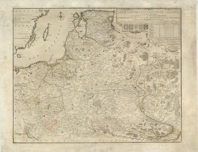
“Les Etats de la Couronne de Pologne, sous les quels sont compris la Grande et la Petite Pologne, le Grand Duche de Lithuanie, les Prusses et la Curlande, Divisez en Provinces et Palatinats”
Map Maker:
Nicolas de Fer
This detailed map of Poland, Lithuania Latvia, Est... (full text available to subscribers)
| Item Detail |
| |
| |
MapMaker: |
Nicolas de Fer
|
|
| |
| |
Subject: |
Eastern Europe |
|
| |
Period/Size: |
1716 / 18.5" x 23.3" (47.0 x 59.2 cm)
|
|
| |
Color: |
Black & White
|
|
| |
Condition: |
Watermarked paper with soiling and a crease at upper-left. A few small holes have been professionally repaired, and one province is outlined in orange. (condition help) |
|
| |
Source: |
|
|
| |
References: |
Malinowski (MCC-25) #103. |
|
| |
|
|
| Sales Information |
| |
| |
Price: |
|
|
| |
| |
Offered by: |
Old World Auctions |
|
| |
Catalog: |
Auction No. 137 - Antique Maps, Charts, Atlases & Globes (7408) |
|
| |
Lot/Item #: |
613 |
|
| |
| |
Date: |
09/2011
|
|
| |
| |
|
Antique Maps - Valuation and Pricing, Descriptions, Resources |
|
Home |
Information |
Search |
Register |
Contact Us |
Site Map
Americana Exchange, Inc. © 1999 - 2024 Americana Exchange, Inc.. All rights reserved.
OldMaps.com, the OldMaps.com logo and
AMPR are service marks or registered service marks of Americana Exchange, Inc..
|