Rister or Sign In to see pricing information


Title:

Sketch of the Country between South Pass and the Great Salt Lake

Map Maker:

U.S. War Department

Sketch of the Country between South Pass and the Great Salt Lake

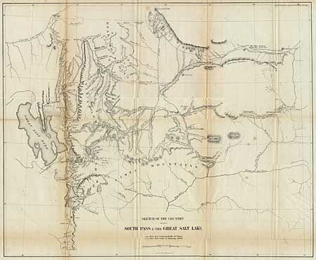
Great map of the one of the most important emigran... (full text available to subscribers)
Item Detail
 
  MapMaker:  

U.S. War Department


  Subject:  Utah  
  Period/Size:  1860 / 17.5" x 21.7"  (44.5 x 55.2 cm)  
  Color:  Black & White  
  Condition:  (B) Some darkening along folds, with a tiny bit of loss at one fold intersection. Backed with Japanese tissue. (condition help)  
  Source:   
  References:  Wheat (TMW) 958.  
 
 
Sales Information
 
  Price: 

Please register your email to view records, or sign in with email address to see records


  Offered by:  Old World Auctions  
  Catalog:  Auction No. 91 - Antique Maps, Charts, Atlases & Globes (163)  
  Lot/Item #:  148  
 
  Date:  06/2000  


Antique Maps - Valuation and Pricing, Descriptions, Resources


Home | Information | Search | Register | Contact Us | Site Map

Americana Exchange, Inc. © 1999 - 2024 Americana Exchange, Inc.. All rights reserved. OldMaps.com, the OldMaps.com logo and
AMPR are service marks or registered service marks of Americana Exchange, Inc..