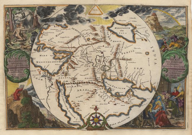
Title:
“Orbis per Creationem Institutus ... / Orbis per Diluvium Destitutus …”
Map Maker:
Romain de Hooghe
This is a very unusual and uncommon map depicting ... (full text available to subscribers)
| Item Detail |
| |
| |
MapMaker: |
Romain de Hooghe
|
|
| |
| |
Subject: |
Near and Middle East |
|
| |
Period/Size: |
1700 / 12.8" x 19.0" (32.6 x 48.3 cm)
|
|
| |
Color: |
Colored
|
|
| |
Condition: |
(A) This example has been skillfully assembled from two separate copies of the map; the map being joined with the surrounding scenes. This restoration is VERY well done and is only recognizable when examined from the back. (condition help) |
|
| |
Source: |
|
|
| |
References: |
|
|
| |
|
|
| Sales Information |
| |
| |
Price: |
|
|
| |
| |
Offered by: |
Old World Auctions |
|
| |
Catalog: |
Auction No. 92 - Antique Maps, Charts, Atlases & Globes (164) |
|
| |
Lot/Item #: |
313 |
|
| |
| |
Date: |
09/2000
|
|
| |
| |
|
Antique Maps - Valuation and Pricing, Descriptions, Resources |
|
Home |
Information |
Search |
Register |
Contact Us |
Site Map
Americana Exchange, Inc. © 1999 - 2024 Americana Exchange, Inc.. All rights reserved.
OldMaps.com, the OldMaps.com logo and
AMPR are service marks or registered service marks of Americana Exchange, Inc..
|