Title:
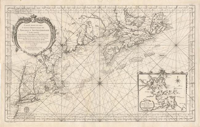
“Carte Reduite des Costes Orientales de l'Amerique Septentrionale. 1st Feuille Contenant l'Isle Royale, l'Accadie, la Bay Francoise, la Nouvelle Angleterre et la Nouvelle Yorc …”
Map Maker:
Jacques Nicolas Bellin
Scarce early issue of this superb large chart of t... (full text available to subscribers)
| Item Detail |
| |
| |
MapMaker: |
Jacques Nicolas Bellin
|
|
| |
| |
Subject: |
Colonial America |
|
| |
Period/Size: |
1757 / 21.5" x 35.0" (54.7 x 88.9 cm)
|
|
| |
Color: |
Black & White
|
|
| |
Condition: |
(A+) Printed on very heavy paper. A few scattered worm holes have been expertly filled, overall very fine condition for such a large sea chart. (condition help) |
|
| |
Source: |
|
|
| |
References: |
|
|
| |
|
|
| Sales Information |
| |
| |
Price: |
|
|
| |
| |
Offered by: |
Old World Auctions |
|
| |
Catalog: |
Auction No. 94 - Antique Maps, Charts, Atlases & Globes (166) |
|
| |
Lot/Item #: |
92 |
|
| |
| |
Date: |
03/2001
|
|
| |
| |
|
Antique Maps - Valuation and Pricing, Descriptions, Resources |
|
Home |
Information |
Search |
Register |
Contact Us |
Site Map
Americana Exchange, Inc. © 1999 - 2024 Americana Exchange, Inc.. All rights reserved.
OldMaps.com, the OldMaps.com logo and
AMPR are service marks or registered service marks of Americana Exchange, Inc..
|