|
|
||
Title:
“Sketch of the North Eastern Boundary disputed between Great Britain and the United States as Settled by Treaty Augt. 9th 1842”
Map Maker:
Wyld [Family]
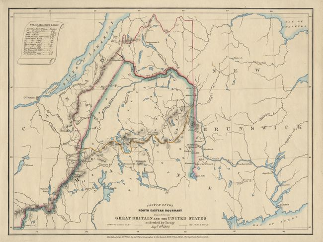
This infrequently seen map details the two boundar... (full text available to subscribers)
|
|
|||||||||||||||||||||||||||||||||||||||||||||||||||||||||||||||||||||||||||||||||||||||||
Antique Maps - Valuation and Pricing, Descriptions, Resources | ||||||||||||||||||||||||||||||||||||||||||||||||||||||||||||||||||||||||||||||||||||||||||
|
Home |
Information |
Search |
Register |
Contact Us |
Site Map
Americana Exchange, Inc. © 1999 - 2024 Americana Exchange, Inc.. All rights reserved.
OldMaps.com, the OldMaps.com logo and |