Title:
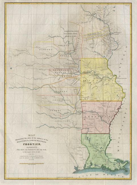
“Map illustrating the plan of the defences of the Western & North-Western Frontier, as proposed by the Hon. J.R. Poinsett, Sec. Of War.”
Map Maker:
Joel Roberts Poinsett
This map was issued as part of the continuing deba... (full text available to subscribers)
| Item Detail |
| |
| |
MapMaker: |
Joel Roberts Poinsett
|
|
| |
| |
Subject: |
Central United States |
|
| |
Period/Size: |
1860 / 21.3" x 15.4" (54.1 x 39.2 cm)
|
|
| |
Color: |
Colored
|
|
| |
Condition: |
(A) Later color with full wash in states and outline color depicting the various Indian tribes. Folding as issued. (condition help) |
|
| |
Source: |
|
|
| |
References: |
|
|
| |
|
|
| Sales Information |
| |
| |
Price: |
|
|
| |
| |
Offered by: |
Old World Auctions |
|
| |
Catalog: |
Auction No. 94 - Antique Maps, Charts, Atlases & Globes (166) |
|
| |
Lot/Item #: |
119 |
|
| |
| |
Date: |
03/2001
|
|
| |
| |
|
Antique Maps - Valuation and Pricing, Descriptions, Resources |
|
Home |
Information |
Search |
Register |
Contact Us |
Site Map
Americana Exchange, Inc. © 1999 - 2024 Americana Exchange, Inc.. All rights reserved.
OldMaps.com, the OldMaps.com logo and
AMPR are service marks or registered service marks of Americana Exchange, Inc..
|