Title:
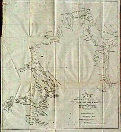
“Map Showing the Line of March of the Centre Divisions, Army of Mexico, under the Command of Brigr. Genl. John E. Wool, from San Antonio de Bexar, Texas to Saltillo, Mexico”
Map Maker:
U.S. Government
A very early map of the region providing detailed ... (full text available to subscribers)
| Item Detail |
| |
| |
MapMaker: |
U.S. Government
|
|
| |
| |
Subject: |
Texas and Mexico |
|
| |
Period/Size: |
1846 / 19.0" x 18.0" (48.3 x 45.8 cm)
|
|
| |
Color: |
Black & White
|
|
| |
Condition: |
(B) Trimmed into neatline at binding side, with a bit of foxing. (condition help) |
|
| |
Source: |
|
|
| |
References: |
Reinhartz & Colley "The Mapping of the American Southwest", p 39. |
|
| |
|
|
| Sales Information |
| |
| |
Price: |
|
|
| |
| |
Offered by: |
Old World Auctions |
|
| |
Catalog: |
Auction No. 88 - Antique Maps, Charts, Atlases & Globes (160) |
|
| |
Lot/Item #: |
130 |
|
| |
| |
Date: |
10/1999
|
|
| |
| |
|
Antique Maps - Valuation and Pricing, Descriptions, Resources |
|
Home |
Information |
Search |
Register |
Contact Us |
Site Map
Americana Exchange, Inc. © 1999 - 2024 Americana Exchange, Inc.. All rights reserved.
OldMaps.com, the OldMaps.com logo and
AMPR are service marks or registered service marks of Americana Exchange, Inc..
|