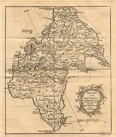
Rister or Sign In to see pricing information


Title:

Old Map of the Continent according to the greatest diametrical Length from the Point of East Tartary to the Cape…

Map Maker:

John Gibson

Old Map of the Continent according to the greatest diametrical Length from the Point of East Tartary to the Cape…

Binder's instructions note the embarrassing error ... (full text available to subscribers)
Item Detail
 
  MapMaker:  

John Gibson


  Subject:  Eastern Hemisphere  
  Period/Size:  1758 / 8.2" x 7.0"  (20.9 x 17.8 cm)  
  Color:  Black & White  
  Condition:  (B) Short tear from bottom right corner into and parallel to neatline about 1.5 inches, repaired with archival tape. (condition help)  
  Source:  Gentleman's Magazine  
  References:  Jolly GENT-121.  
 
 
Sales Information
 
  Price: 

Please register your email to view records, or sign in with email address to see records


  Offered by:  Old World Auctions  
  Catalog:  Auction No. 88 - Antique Maps, Charts, Atlases & Globes (160)  
  Lot/Item #:  166  
 
  Date:  10/1999  


Antique Maps - Valuation and Pricing, Descriptions, Resources


Home | Information | Search | Register | Contact Us | Site Map

Americana Exchange, Inc. © 1999 - 2024 Americana Exchange, Inc.. All rights reserved. OldMaps.com, the OldMaps.com logo and
AMPR are service marks or registered service marks of Americana Exchange, Inc..