Title:
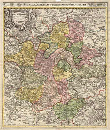
“Agri Parisiensis Tabula partieularis, qua maxima Pars Insulae Franciae, seu Regiae celeberrimaeq Parisiorum Urbis vicina Regio in fuas Castellanias accurate divisa exhibetur”
Map Maker:
Johann Baptist Homann
Extremely detailed map showing detail down to tiny... (full text available to subscribers)
| Item Detail |
| |
| |
MapMaker: |
Johann Baptist Homann
|
|
| |
| |
Subject: |
France |
|
| |
Period/Size: |
1720 / 22.5" x 19.0" (57.2 x 48.3 cm)
|
|
| |
Color: |
Colored
|
|
| |
Condition: |
(A) A very strong & crisp impression. A thumb sized piece of paper missing at top margin not affecting neatline. (condition help) |
|
| |
Source: |
|
|
| |
References: |
|
|
| |
|
|
| Sales Information |
| |
| |
Price: |
|
|
| |
| |
Offered by: |
Old World Auctions |
|
| |
Catalog: |
Auction No. 94 - Antique Maps, Charts, Atlases & Globes (166) |
|
| |
Lot/Item #: |
288 |
|
| |
| |
Date: |
03/2001
|
|
| |
| |
|
Antique Maps - Valuation and Pricing, Descriptions, Resources |
|
Home |
Information |
Search |
Register |
Contact Us |
Site Map
Americana Exchange, Inc. © 1999 - 2024 Americana Exchange, Inc.. All rights reserved.
OldMaps.com, the OldMaps.com logo and
AMPR are service marks or registered service marks of Americana Exchange, Inc..
|