Title:
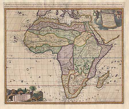
“L'Afrique divisée suivant l' estenduie de ses principales partiesnou sont distingués les uns des autres Les Empires, Monarchies, Royaumes Tstats et Peuples”
Map Maker:
Gerard Valk
Large copper engraved map of the continent with de... (full text available to subscribers)
| Item Detail |
| |
| |
MapMaker: |
Gerard Valk
|
|
| |
| |
Subject: |
Africa |
|
| |
Period/Size: |
1680 / 19.2" x 23.0" (48.8 x 58.5 cm)
|
|
| |
Color: |
Colored
|
|
| |
Condition: |
(B) At some point in the past the map has been remargined and backed with heavy linen. Lightly toned with a bit of faint discoloration. (condition help) |
|
| |
Source: |
|
|
| |
References: |
Norwich #49. |
|
| |
|
|
| Sales Information |
| |
| |
Price: |
|
|
| |
| |
Offered by: |
Old World Auctions |
|
| |
Catalog: |
Auction No. 94 - Antique Maps, Charts, Atlases & Globes (166) |
|
| |
Lot/Item #: |
386 |
|
| |
| |
Date: |
03/2001
|
|
| |
| |
|
Antique Maps - Valuation and Pricing, Descriptions, Resources |
|
Home |
Information |
Search |
Register |
Contact Us |
Site Map
Americana Exchange, Inc. © 1999 - 2024 Americana Exchange, Inc.. All rights reserved.
OldMaps.com, the OldMaps.com logo and
AMPR are service marks or registered service marks of Americana Exchange, Inc..
|