Title:
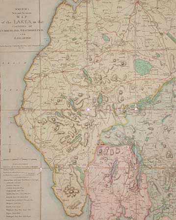
“Smith's New and Accurate Map of the Lakes, in the Counties of Cumberland, Westmoreland and Lancaster”
Map Maker:
Charles Smith
Dissected and linen backed folding map, extending ... (full text available to subscribers)
| Item Detail |
| |
| |
MapMaker: |
Charles Smith
|
|
| |
| |
Subject: |
England |
|
| |
Period/Size: |
1802 / 23.5" x 19.0" (59.7 x 48.3 cm)
|
|
| |
Color: |
Colored
|
|
| |
Condition: |
(A) The original pastel colors are tastefully applied. Backing worn at fold junctions with a couple of short splits not affecting paper, else fine. (condition help) |
|
| |
Source: |
|
|
| |
References: |
|
|
| |
|
|
| Sales Information |
| |
| |
Price: |
|
|
| |
| |
Offered by: |
Old World Auctions |
|
| |
Catalog: |
Auction No. 95 - Antique Maps, Charts, Atlases & Globes (167) |
|
| |
Lot/Item #: |
238 |
|
| |
| |
Date: |
06/2001
|
|
| |
| |
|
Antique Maps - Valuation and Pricing, Descriptions, Resources |
|
Home |
Information |
Search |
Register |
Contact Us |
Site Map
Americana Exchange, Inc. © 1999 - 2024 Americana Exchange, Inc.. All rights reserved.
OldMaps.com, the OldMaps.com logo and
AMPR are service marks or registered service marks of Americana Exchange, Inc..
|