Title:
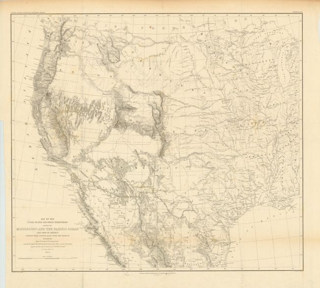
“Report on the United States and Mexican Boundary Survey, Made Under The Direction of the Secretary of the Interior… Vol. I.”
Map Maker:
William Hemsley Emory
After the Treaty of Guadeloupe, Hidalgo (1848), wh... (full text available to subscribers)
| Item Detail |
| |
| |
MapMaker: |
William Hemsley Emory
|
|
| |
| |
Subject: |
Exploration and Surveys |
|
| |
Period/Size: |
1857 / 12.0" x 9.0" (30.5 x 22.9 cm)
|
|
| |
Color: |
Colored
|
|
| |
Condition: |
Complete with all pages and plates. The folding map is in good condition with a binding trim at lower left and is separated from the text. The pages and plates are lightly toned with some damp staining and scattered foxing. The report has been professi (condition help) |
|
| |
Source: |
Ex. Doc. No. 135, 34th Cong, 1st Sess. |
|
| |
References: |
|
|
| |
|
|
| Sales Information |
| |
| |
Price: |
|
|
| |
| |
Offered by: |
Old World Auctions |
|
| |
Catalog: |
Auction No. 138 - Antique Maps, Charts, Atlases & Globes (7409) |
|
| |
Lot/Item #: |
918 |
|
| |
| |
Date: |
12/2011
|
|
| |
| |
|
Antique Maps - Valuation and Pricing, Descriptions, Resources |
|
Home |
Information |
Search |
Register |
Contact Us |
Site Map
Americana Exchange, Inc. © 1999 - 2024 Americana Exchange, Inc.. All rights reserved.
OldMaps.com, the OldMaps.com logo and
AMPR are service marks or registered service marks of Americana Exchange, Inc..
|