Title:
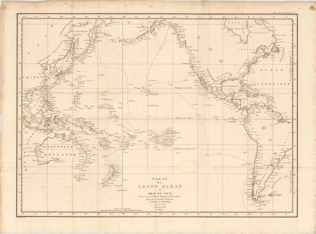
“Carte du Grand Ocean ou Mer du Sud Dressee pour la Relation du Voyage de Decouvertes faites par les Fregates Francaises la Boussole et l'Astrolabe dans les Annees 1785, 86, 87 et 88”
Map Maker:
Jean Francois Galaup de La Perouse
Jean-Francois de Galaup, Comte de La Perouse comma... (full text available to subscribers)
| Item Detail |
| |
| |
MapMaker: |
Jean Francois Galaup de La Perouse
|
|
| |
| |
Subject: |
Pacific Ocean |
|
| |
Period/Size: |
1797 / 20.0" x 27.5" (50.8 x 69.9 cm)
|
|
| |
Color: |
Black & White
|
|
| |
Condition: |
Wide margins on watermarked paper with old folds to accommodate binding into a book. One short fold separation in bottom margin that does not enter map image, and one tear that enters map image 1" at bottom. There are two faint damp stains in blank area (condition help) |
|
| |
Source: |
Atlas du Voyage de la Perouse |
|
| |
References: |
Tooley (Australia), p. 111, #834; Wagner #838; Falk (Alaska) #1797-6. |
|
| |
|
|
| Sales Information |
| |
| |
Price: |
|
|
| |
| |
Offered by: |
Old World Auctions |
|
| |
Catalog: |
Auction No. 138 - Antique Maps, Charts, Atlases & Globes (7409) |
|
| |
Lot/Item #: |
839 |
|
| |
| |
Date: |
12/2011
|
|
| |
| |
|
Antique Maps - Valuation and Pricing, Descriptions, Resources |
|
Home |
Information |
Search |
Register |
Contact Us |
Site Map
Americana Exchange, Inc. © 1999 - 2024 Americana Exchange, Inc.. All rights reserved.
OldMaps.com, the OldMaps.com logo and
AMPR are service marks or registered service marks of Americana Exchange, Inc..
|