Title:
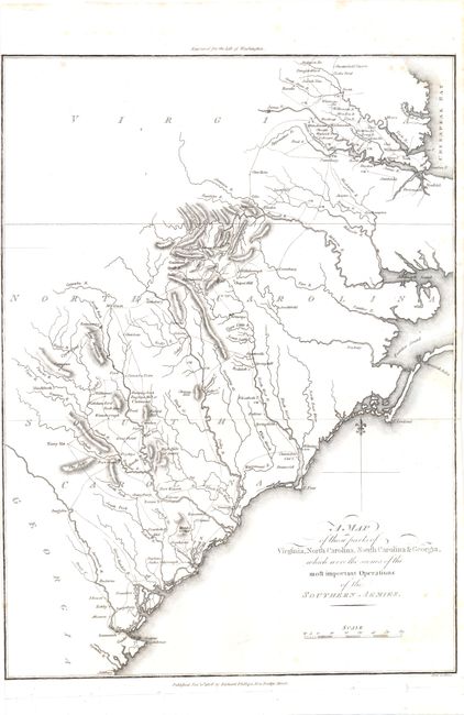
“A Map of Those Parts of Virginia, North Carolina, South Carolina & Georgia which were the Scenes of the Most Important Operations of the Southern Armies”
Map Maker:
Samuel Lewis
This map documents the route of Cornwallis' Southe... (full text available to subscribers)
| Item Detail |
| |
| |
MapMaker: |
Samuel Lewis
|
|
| |
| |
Subject: |
Southeast United States |
|
| |
Period/Size: |
1806 / 14.3" x 10.3" (36.4 x 26.2 cm)
|
|
| |
Color: |
Black & White
|
|
| |
Condition: |
The left margin is trimmed to the neatline and the right margin is narrow, with a few scattered spots in the image. Issued folding. (condition help) |
|
| |
Source: |
Life of Washington |
|
| |
References: |
|
|
| |
|
|
| Sales Information |
| |
| |
Price: |
|
|
| |
| |
Offered by: |
Old World Auctions |
|
| |
Catalog: |
Auction No. 138 - Antique Maps, Charts, Atlases & Globes (7409) |
|
| |
Lot/Item #: |
217 |
|
| |
| |
Date: |
12/2011
|
|
| |
| |
|
Antique Maps - Valuation and Pricing, Descriptions, Resources |
|
Home |
Information |
Search |
Register |
Contact Us |
Site Map
Americana Exchange, Inc. © 1999 - 2024 Americana Exchange, Inc.. All rights reserved.
OldMaps.com, the OldMaps.com logo and
AMPR are service marks or registered service marks of Americana Exchange, Inc..
|