Title:
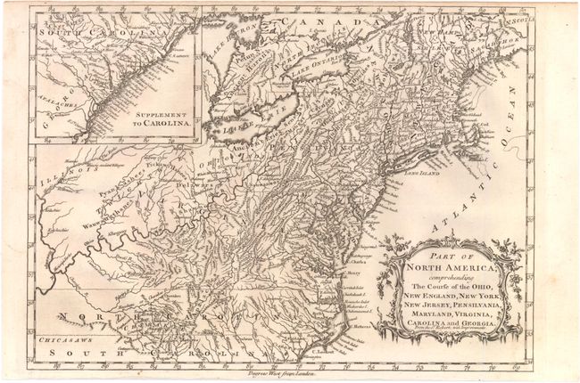
“Part of North America; Comprehending the Course of the Ohio, New England, New York, New Jersey, Pensilvania, Maryland, Virginia, Carolina and Georgia.”
Map Maker:
John BARROW
A finely engraved, small map based on a larger map... (full text available to subscribers)
| Item Detail |
| |
| |
MapMaker: |
John BARROW
|
|
| |
| |
Subject: |
Colonial Eastern United States |
|
| |
Period/Size: |
1760 / 8.5" x 11.8" (21.6 x 30.0 cm)
|
|
| |
Color: |
Black & White
|
|
| |
Condition: |
Lightly toned with narrow top and bottom margins, as issued, else very good. (condition help) |
|
| |
Source: |
New Geographical Dictionary |
|
| |
References: |
McCorkle #759.2 |
|
| |
|
|
| Sales Information |
| |
| |
Price: |
|
|
| |
| |
Offered by: |
Old World Auctions |
|
| |
Catalog: |
Auction No. 138 - Antique Maps, Charts, Atlases & Globes (7409) |
|
| |
Lot/Item #: |
178 |
|
| |
| |
Date: |
12/2011
|
|
| |
| |
|
Antique Maps - Valuation and Pricing, Descriptions, Resources |
|
Home |
Information |
Search |
Register |
Contact Us |
Site Map
Americana Exchange, Inc. © 1999 - 2024 Americana Exchange, Inc.. All rights reserved.
OldMaps.com, the OldMaps.com logo and
AMPR are service marks or registered service marks of Americana Exchange, Inc..
|