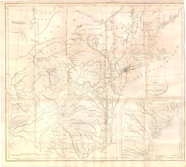
Title:
“Part of the United States of North America”
Map Maker:
John Stockdale
This map of the young United States is filled with... (full text available to subscribers)
| Item Detail |
| |
| |
MapMaker: |
John Stockdale
|
|
| |
| |
Subject: |
Eastern United States |
|
| |
Period/Size: |
1798 / 16.0" x 18.3" (40.7 x 46.5 cm)
|
|
| |
Color: |
Black & White
|
|
| |
Condition: |
Issued folding and trimmed to the neatline at binding side. There is light offsetting in the image and a small tear in the right margin that extends one-inch past the neatline which has been repaired on verso. (condition help) |
|
| |
Source: |
Travels Through the States of North America |
|
| |
References: |
McCorkle #798.5. |
|
| |
|
|
| Sales Information |
| |
| |
Price: |
|
|
| |
| |
Offered by: |
Old World Auctions |
|
| |
Catalog: |
Auction No. 138 - Antique Maps, Charts, Atlases & Globes (7409) |
|
| |
Lot/Item #: |
180 |
|
| |
| |
Date: |
12/2011
|
|
| |
| |
|
Antique Maps - Valuation and Pricing, Descriptions, Resources |
|
Home |
Information |
Search |
Register |
Contact Us |
Site Map
Americana Exchange, Inc. © 1999 - 2024 Americana Exchange, Inc.. All rights reserved.
OldMaps.com, the OldMaps.com logo and
AMPR are service marks or registered service marks of Americana Exchange, Inc..
|