Title:
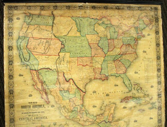
“New Map of that portion of North America, exhibiting the United States and Territories, the Canadas, New Brunswick, Nova Scotia and Mexico, also, Central America and the West India Islands”
Map Maker:
Jacob Monk
This majestic wall map was published just as the c... (full text available to subscribers)
| Item Detail |
| |
| |
MapMaker: |
Jacob Monk
|
|
| |
| |
Subject: |
North America |
|
| |
Period/Size: |
1853 / 56.0" x 59.0" (142.3 x 149.9 cm)
|
|
| |
Color: |
Colored
|
|
| |
Condition: |
There is some small image and paper losses in the upper middle portion of the image and in the bottom corners. There is also a six-inch tear in the lower left portion of the image. The map is lacking the ribbon edging and is attached to the top roller o (condition help) |
|
| |
Source: |
|
|
| |
References: |
cf. Wheat (TMW) #794; cf. Wheat (GOLD) 243; cf. Rumsey #602. |
|
| |
|
|
| Sales Information |
| |
| |
Price: |
|
|
| |
| |
Offered by: |
Old World Auctions |
|
| |
Catalog: |
Auction No. 138 - Antique Maps, Charts, Atlases & Globes (7409) |
|
| |
Lot/Item #: |
119 |
|
| |
| |
Date: |
12/2011
|
|
| |
| |
|
Antique Maps - Valuation and Pricing, Descriptions, Resources |
|
Home |
Information |
Search |
Register |
Contact Us |
Site Map
Americana Exchange, Inc. © 1999 - 2024 Americana Exchange, Inc.. All rights reserved.
OldMaps.com, the OldMaps.com logo and
AMPR are service marks or registered service marks of Americana Exchange, Inc..
|