Title:
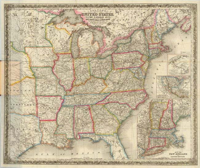
“Colton's Map of the United States, the Canadas &c. Showing the Rail Roads, Canals & Stage Roads…”
Map Maker:
Joseph Hutchins Colton
This very large, folding map offers an exceedingly... (full text available to subscribers)
| Item Detail |
| |
| |
MapMaker: |
Joseph Hutchins Colton
|
|
| |
| |
Subject: |
Eastern United States |
|
| |
Period/Size: |
1851 / 25.5" x 30.3" (64.8 x 77.0 cm)
|
|
| |
Color: |
Colored
|
|
| |
Condition: |
A dark impression with original outline color and a few minute separations at fold intersections. Covers are lightly worn with some fading with a stamp adhered to the front cover. This is an excellent example of this pocket map. (condition help) |
|
| |
Source: |
|
|
| |
References: |
|
|
| |
|
|
| Sales Information |
| |
| |
Price: |
|
|
| |
| |
Offered by: |
Old World Auctions |
|
| |
Catalog: |
Auction No. 138 - Antique Maps, Charts, Atlases & Globes (7409) |
|
| |
Lot/Item #: |
187 |
|
| |
| |
Date: |
12/2011
|
|
| |
| |
|
Antique Maps - Valuation and Pricing, Descriptions, Resources |
|
Home |
Information |
Search |
Register |
Contact Us |
Site Map
Americana Exchange, Inc. © 1999 - 2024 Americana Exchange, Inc.. All rights reserved.
OldMaps.com, the OldMaps.com logo and
AMPR are service marks or registered service marks of Americana Exchange, Inc..
|