Title:
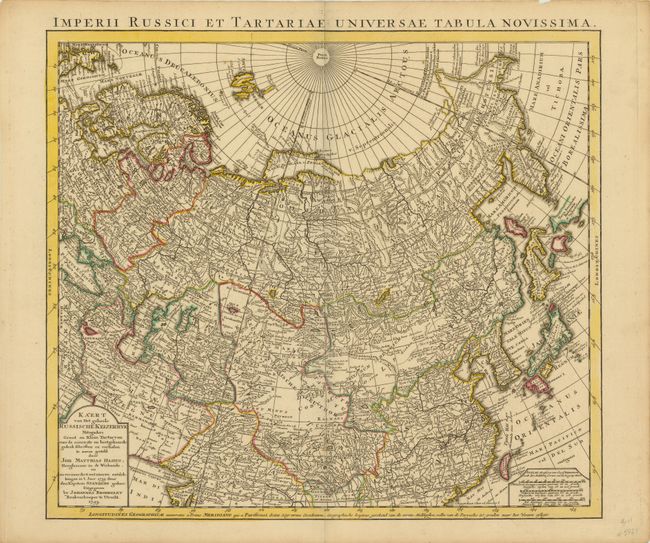
“Imperii Russici et Tartariae Universae Tabula Novissima / Kaert van het Geheele Russische Keizerryk”
Map Maker:
Johannes Broedelet
Finely engraved and detailed map by Johannes Broed... (full text available to subscribers)
| Item Detail |
| |
| |
MapMaker: |
Johannes Broedelet
|
|
| |
| |
Subject: |
Northern Asia, Russian Empire |
|
| |
Period/Size: |
1743 / 19.5" x 21.5" (49.6 x 54.7 cm)
|
|
| |
Color: |
Colored
|
|
| |
Condition: |
Original outline color with a short centerfold separation that just enters map border at bottom that has been closed on verso with old paper. (condition help) |
|
| |
Source: |
|
|
| |
References: |
|
|
| |
|
|
| Sales Information |
| |
| |
Price: |
|
|
| |
| |
Offered by: |
Old World Auctions |
|
| |
Catalog: |
Auction No. 138 - Antique Maps, Charts, Atlases & Globes (7409) |
|
| |
Lot/Item #: |
757 |
|
| |
| |
Date: |
12/2011
|
|
| |
| |
|
Antique Maps - Valuation and Pricing, Descriptions, Resources |
|
Home |
Information |
Search |
Register |
Contact Us |
Site Map
Americana Exchange, Inc. © 1999 - 2024 Americana Exchange, Inc.. All rights reserved.
OldMaps.com, the OldMaps.com logo and
AMPR are service marks or registered service marks of Americana Exchange, Inc..
|