| Item Detail |
| |
| |
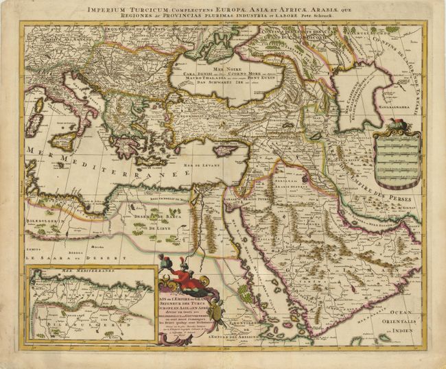
MapMaker: |
Petrus Schenk
|
|
| |
| |
Subject: |
Eastern Mediterranean & Middle East |
|
| |
Period/Size: |
1700 / 18.3" x 22.5" (46.5 x 57.2 cm)
|
|
| |
Color: |
Colored
|
|
| |
Condition: |
Original color on watermarked paper with a few faint spots and a minute wormhole in scale of miles cartouche. There is minor soiling in blank margins and a centerfold separation that enters 2" into map image at bottom that has been professionally repaire (condition help) |
|
| |
Source: |
|
|
| |
References: |
Tibbetts, G.R. #181. |
|
| |
|
|
| Sales Information |
| |
| |
Price: |
|
|
| |
| |
Offered by: |
Old World Auctions |
|
| |
Catalog: |
Auction No. 138 - Antique Maps, Charts, Atlases & Globes (7409) |
|
| |
Lot/Item #: |
706 |
|
| |
| |
Date: |
12/2011
|
|
| |
| |
|