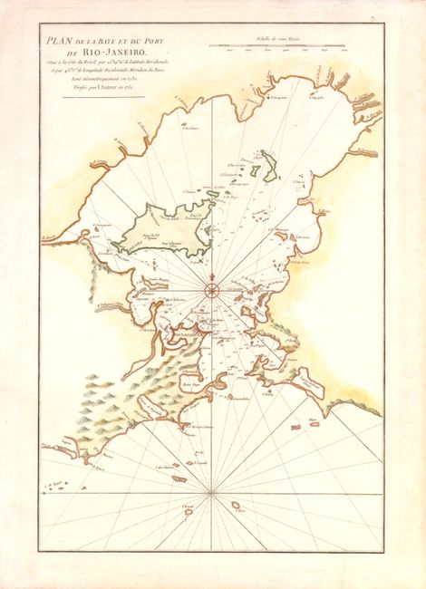
Title:
“Plan de la Baye et du Port de Rio-Janeiro…”
Map Maker:
Jean B.N.D. d' Apres de Mannevillette
This important, early chart of the harbor shows Ri... (full text available to subscribers)
| Item Detail |
| |
| |
MapMaker: |
Jean B.N.D. d' Apres de Mannevillette
|
|
| |
| |
Subject: |
Rio de Janeiro, Brazil |
|
| |
Period/Size: |
1775 / 19.3" x 12.5" (49.1 x 31.8 cm)
|
|
| |
Color: |
Colored
|
|
| |
Condition: |
Watermarked paper with light soiling in blank margins and a tiny tear in bottom blank margin that has been closed on verso with archival tape. (condition help) |
|
| |
Source: |
Le Neptune Oriental |
|
| |
References: |
|
|
| |
|
|
| Sales Information |
| |
| |
Price: |
|
|
| |
| |
Offered by: |
Old World Auctions |
|
| |
Catalog: |
Auction No. 139 - Antique Maps, Charts, Atlases & Globes (9028) |
|
| |
Lot/Item #: |
360 |
|
| |
| |
Date: |
02/2012
|
|
| |
| |
|
Antique Maps - Valuation and Pricing, Descriptions, Resources |
|
Home |
Information |
Search |
Register |
Contact Us |
Site Map
Americana Exchange, Inc. © 1999 - 2024 Americana Exchange, Inc.. All rights reserved.
OldMaps.com, the OldMaps.com logo and
AMPR are service marks or registered service marks of Americana Exchange, Inc..
|