| Item Detail |
| |
| |
MapMaker: |
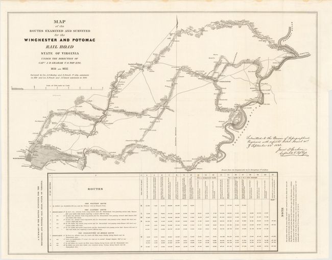
Andrew Atkinson Humphreys
|
|
| |
| |
Subject: |
Virginia |
|
| |
Period/Size: |
1832 / 21.3" x 27.0" (54.1 x 68.6 cm)
|
|
| |
Color: |
Black & White
|
|
| |
Condition: |
The map is clean and bright with a very small tear at the right binding trim that extends 0.5" into the image. Issued folding. (condition help) |
|
| |
Source: |
24th Congress, 2nd Session, HR Doc. 465 |
|
| |
References: |
Claussen & Friis #271; Modelski (Railroads) #4. |
|
| |
|
|
| Sales Information |
| |
| |
Price: |
|
|
| |
| |
Offered by: |
Old World Auctions |
|
| |
Catalog: |
Auction No. 139 - Antique Maps, Charts, Atlases & Globes (9028) |
|
| |
Lot/Item #: |
272 |
|
| |
| |
Date: |
02/2012
|
|
| |
| |
|