Title:
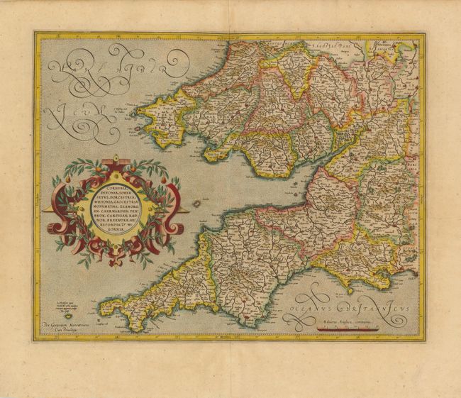
“Cornubia, Devonia, Somersetus, Dorcestria, Wiltonia, Glocestria Monumetha, Glamorgan, Caermarden, Penbrok, Cardigan, Radnor, Breknoke, Herefordia, & Wigornia”
Map Maker:
Gerard Mercator
This handsome map covers southwest England, descri... (full text available to subscribers)
| Item Detail |
| |
| |
MapMaker: |
Gerard Mercator
|
|
| |
| |
Subject: |
England & Wales |
|
| |
Period/Size: |
1613 / 14.8" x 18.5" (37.6 x 47.0 cm)
|
|
| |
Color: |
Colored
|
|
| |
Condition: |
Wide margins, with a few unobtrusive spots and minor creasing at top near centerfold.. Remnants of hinge tape on verso. (condition help) |
|
| |
Source: |
Gerard Mercatoris Atlas |
|
| |
References: |
|
|
| |
|
|
| Sales Information |
| |
| |
Price: |
|
|
| |
| |
Offered by: |
Old World Auctions |
|
| |
Catalog: |
Auction No. 139 - Antique Maps, Charts, Atlases & Globes (9028) |
|
| |
Lot/Item #: |
414 |
|
| |
| |
Date: |
02/2012
|
|
| |
| |
|
Antique Maps - Valuation and Pricing, Descriptions, Resources |
|
Home |
Information |
Search |
Register |
Contact Us |
Site Map
Americana Exchange, Inc. © 1999 - 2024 Americana Exchange, Inc.. All rights reserved.
OldMaps.com, the OldMaps.com logo and
AMPR are service marks or registered service marks of Americana Exchange, Inc..
|