| Item Detail |
| |
| |
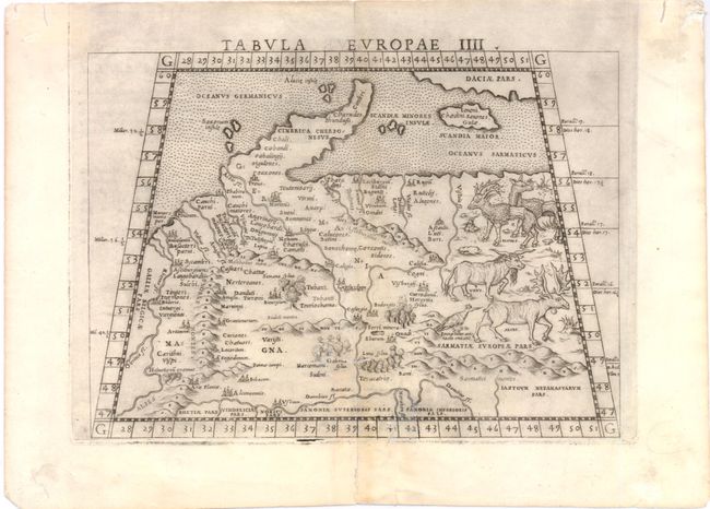
MapMaker: |
Girolamo Ruscelli
|
|
| |
| |
Subject: |
Northern Europe, Germany and Denmark |
|
| |
Period/Size: |
1561 / 10.0" x 9.8" (25.4 x 24.9 cm)
|
|
| |
Color: |
Black & White
|
|
| |
Condition: |
Light toning along centerfold with a few faint spots and short centerfold separations in blank margins. There is a small worm track along centerfold and several additional small tracks in blank margins. (condition help) |
|
| |
Source: |
La Geografia di Claudio Tolomeo Allessadrinoģ |
|
| |
References: |
|
|
| |
|
|
| Sales Information |
| |
| |
Price: |
|
|
| |
| |
Offered by: |
Old World Auctions |
|
| |
Catalog: |
Auction No. 139 - Antique Maps, Charts, Atlases & Globes (9028) |
|
| |
Lot/Item #: |
428 |
|
| |
| |
Date: |
02/2012
|
|
| |
| |
|