| Item Detail |
| |
| |
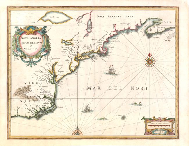
MapMaker: |
Jan Jansson
|
|
| |
| |
Subject: |
Colonial New England and Mid-Atlantic |
|
| |
Period/Size: |
1636 / 15.3" x 20.0" (38.9 x 50.8 cm)
|
|
| |
Color: |
Colored
|
|
| |
Condition: |
Watermarked paper with a printer's crease adjacent to centerfold. Chips in top corners have been professionally repaired, with a minute amount of neatline in facsimile in top left corner. (condition help) |
|
| |
Source: |
|
|
| |
References: |
Burden #247; Cumming (SE) #39; Karpinski, p. 26 & 31 plt. II; McCorkle #636.2. |
|
| |
|
|
| Sales Information |
| |
| |
Price: |
|
|
| |
| |
Offered by: |
Old World Auctions |
|
| |
Catalog: |
Auction No. 139 - Antique Maps, Charts, Atlases & Globes (9028) |
|
| |
Lot/Item #: |
152 |
|
| |
| |
Date: |
02/2012
|
|
| |
| |
|