| Item Detail |
| |
| |
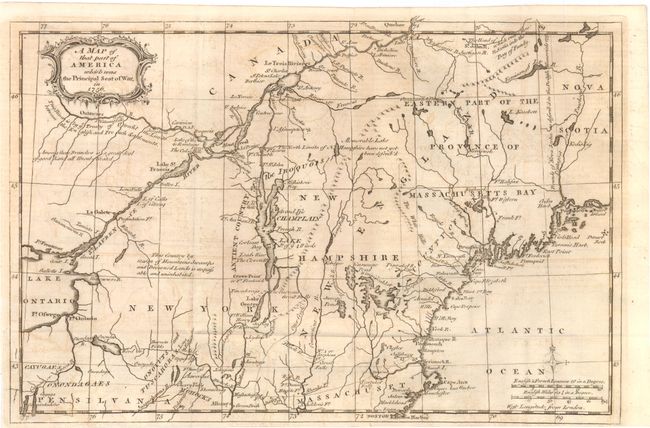
MapMaker: |
Anonymous
|
|
| |
| |
Subject: |
Colonial New England and Mid-Atlantic |
|
| |
Period/Size: |
1757 / 8.8" x 13.3" (22.4 x 33.8 cm)
|
|
| |
Color: |
Black & White
|
|
| |
Condition: |
There is some light offsetting in the image, else very good. Issued folding. (condition help) |
|
| |
Source: |
Gentlemen's Magazine |
|
| |
References: |
Jolly GENT-102; Sellers & van Ee #78; McCorkle 757.4. |
|
| |
|
|
| Sales Information |
| |
| |
Price: |
|
|
| |
| |
Offered by: |
Old World Auctions |
|
| |
Catalog: |
Auction No. 139 - Antique Maps, Charts, Atlases & Globes (9028) |
|
| |
Lot/Item #: |
155 |
|
| |
| |
Date: |
02/2012
|
|
| |
| |
|