Title:
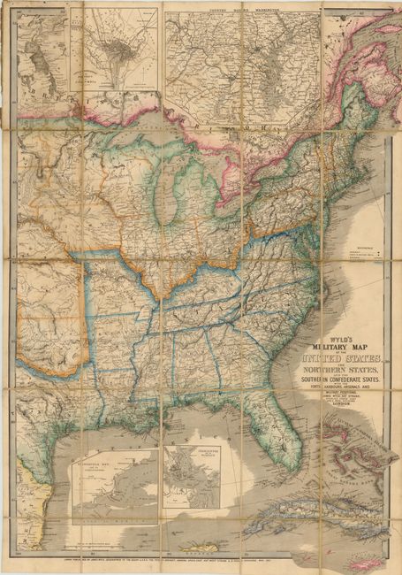
“Wyld's Military Map of the United States, the Northern States, and the Southern Confederate States, with the Forts, Harbours, Arsenals, and Military Positions”
Map Maker:
James Wyld
This is a colorful and detailed map of the United ... (full text available to subscribers)
| Item Detail |
| |
| |
MapMaker: |
James Wyld
|
|
| |
| |
Subject: |
Eastern United States |
|
| |
Period/Size: |
1861 / 35.0" x 23.3" (88.9 x 59.2 cm)
|
|
| |
Color: |
Colored
|
|
| |
Condition: |
Original outline color and dissected and mounted on linen, as issued with some light scattered foxing. The map is missing its brown embossed covers. (condition help) |
|
| |
Source: |
|
|
| |
References: |
Stephenson #19. |
|
| |
|
|
| Sales Information |
| |
| |
Price: |
|
|
| |
| |
Offered by: |
Old World Auctions |
|
| |
Catalog: |
Auction No. 139 - Antique Maps, Charts, Atlases & Globes (9028) |
|
| |
Lot/Item #: |
150 |
|
| |
| |
Date: |
02/2012
|
|
| |
| |
|
Antique Maps - Valuation and Pricing, Descriptions, Resources |
|
Home |
Information |
Search |
Register |
Contact Us |
Site Map
Americana Exchange, Inc. © 1999 - 2024 Americana Exchange, Inc.. All rights reserved.
OldMaps.com, the OldMaps.com logo and
AMPR are service marks or registered service marks of Americana Exchange, Inc..
|