Title:
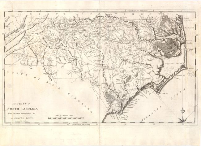
“The State of North Carolina from the Best Authorities, &c. by Samuel Lewis”
Map Maker:
Lewis/Carey
This early map displays wagon roads, towns, rivers... (full text available to subscribers)
| Item Detail |
| |
| |
MapMaker: |
Lewis/Carey
|
|
| |
| |
Subject: |
North Carolina |
|
| |
Period/Size: |
1795 / 11.0" x 18.5" (28.0 x 47.0 cm)
|
|
| |
Color: |
Black & White
|
|
| |
Condition: |
There is some minor offsetting and staining in the image, and a few edge tears (including one that enters the map border at lower left) that have been repaired and reinforced on verso with archival material. There is a printer's crease in the upper right (condition help) |
|
| |
Source: |
Careyĺs American Atlas |
|
| |
References: |
Wheat & Brun #581. |
|
| |
|
|
| Sales Information |
| |
| |
Price: |
|
|
| |
| |
Offered by: |
Old World Auctions |
|
| |
Catalog: |
Auction No. 139 - Antique Maps, Charts, Atlases & Globes (9028) |
|
| |
Lot/Item #: |
259 |
|
| |
| |
Date: |
02/2012
|
|
| |
| |
|
Antique Maps - Valuation and Pricing, Descriptions, Resources |
|
Home |
Information |
Search |
Register |
Contact Us |
Site Map
Americana Exchange, Inc. © 1999 - 2024 Americana Exchange, Inc.. All rights reserved.
OldMaps.com, the OldMaps.com logo and
AMPR are service marks or registered service marks of Americana Exchange, Inc..
|