Title:
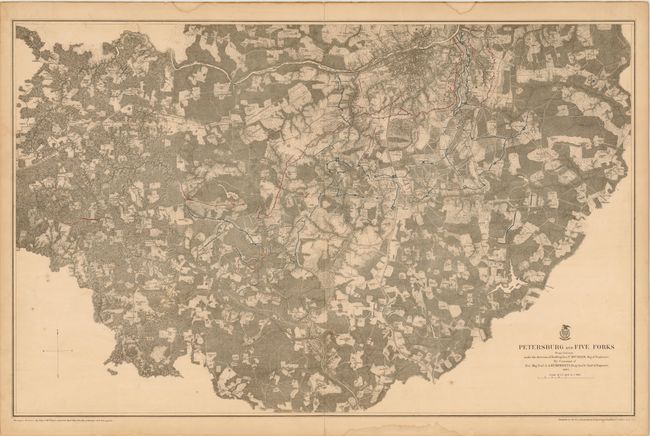
“Petersburg and Five Forks from Surveys under the Direction of Bvt. Brig. Gen. N. Michler, Maj. of Engineers…”
Map Maker:
U.S. War Department
This is a detailed topographic map with the Appoma... (full text available to subscribers)
| Item Detail |
| |
| |
MapMaker: |
U.S. War Department
|
|
| |
| |
Subject: |
Virginia, Civil War |
|
| |
Period/Size: |
1867 / 21.3" x 33.5" (54.1 x 85.1 cm)
|
|
| |
Color: |
Colored
|
|
| |
Condition: |
Centerfold separations at top and bottom that extend just past the neatline, and there are a few isolated spots of foxing. There are also several damp stains that are confined to the blank margins. Backed with linen. (condition help) |
|
| |
Source: |
|
|
| |
References: |
Stephenson #607.9; Phillips (A) #3688-11 |
|
| |
|
|
| Sales Information |
| |
| |
Price: |
|
|
| |
| |
Offered by: |
Old World Auctions |
|
| |
Catalog: |
Auction No. 140 - Antique Maps, Charts, Atlases & Globes (9029) |
|
| |
Lot/Item #: |
320 |
|
| |
| |
Date: |
05/2012
|
|
| |
| |
|
Antique Maps - Valuation and Pricing, Descriptions, Resources |
|
Home |
Information |
Search |
Register |
Contact Us |
Site Map
Americana Exchange, Inc. © 1999 - 2024 Americana Exchange, Inc.. All rights reserved.
OldMaps.com, the OldMaps.com logo and
AMPR are service marks or registered service marks of Americana Exchange, Inc..
|