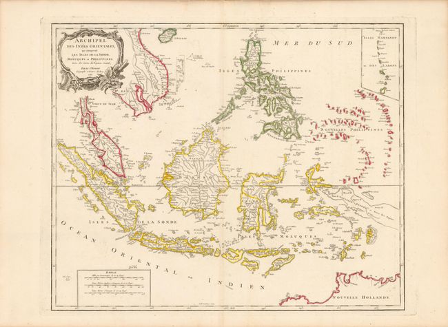
Title:
“Archipel des Indes Orientales, qui Comprend les Isles de la Sonde, Moluques et Philippines”
Map Maker:
Gilles Robert de Vaugondy
A detailed depiction of the region centered on Bor... (full text available to subscribers)
| Item Detail |
| |
| |
MapMaker: |
Gilles Robert de Vaugondy
|
|
| |
| |
Subject: |
Southeast Asia |
|
| |
Period/Size: |
1750 / 19.0" x 23.5" (48.3 x 59.7 cm)
|
|
| |
Color: |
Colored
|
|
| |
Condition: |
Wide margins and original outline color with an unobtrusive paper flaw in blank area of map image along bottom centerfold. (condition help) |
|
| |
Source: |
Atlas Universel |
|
| |
References: |
Pedley #413. |
|
| |
|
|
| Sales Information |
| |
| |
Price: |
|
|
| |
| |
Offered by: |
Old World Auctions |
|
| |
Catalog: |
Auction No. 140 - Antique Maps, Charts, Atlases & Globes (9029) |
|
| |
Lot/Item #: |
781 |
|
| |
| |
Date: |
05/2012
|
|
| |
| |
|
Antique Maps - Valuation and Pricing, Descriptions, Resources |
|
Home |
Information |
Search |
Register |
Contact Us |
Site Map
Americana Exchange, Inc. © 1999 - 2024 Americana Exchange, Inc.. All rights reserved.
OldMaps.com, the OldMaps.com logo and
AMPR are service marks or registered service marks of Americana Exchange, Inc..
|