Title:
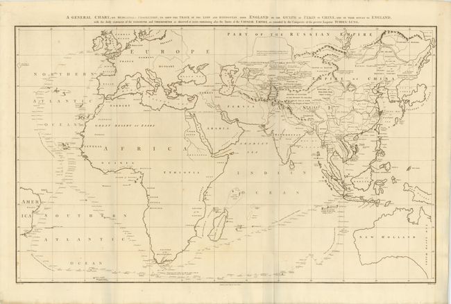
“A General Chart on Mercator's Projection, to Shew the Track of the Lion and Hindostan from England to the Gulph of Pekin in China, … also the Limits of the Chinese Empire, as Extended by the Conquests of the Present Emperor Tchien-Lung.”
Map Maker:
John BARROW
This large chart was part of an account of George ... (full text available to subscribers)
| Item Detail |
| |
| |
MapMaker: |
John BARROW
|
|
| |
| |
Subject: |
World |
|
| |
Period/Size: |
1796 / 23.5" x 36.5" (59.7 x 92.8 cm)
|
|
| |
Color: |
Black & White
|
|
| |
Condition: |
Nice impression on thick, watermarked paper with a few tiny spots, else fine. (condition help) |
|
| |
Source: |
An Authentic Account of an Embassy from the King of Great Britain… |
|
| |
References: |
|
|
| |
|
|
| Sales Information |
| |
| |
Price: |
|
|
| |
| |
Offered by: |
Old World Auctions |
|
| |
Catalog: |
Auction No. 140 - Antique Maps, Charts, Atlases & Globes (9029) |
|
| |
Lot/Item #: |
32 |
|
| |
| |
Date: |
05/2012
|
|
| |
| |
|
Antique Maps - Valuation and Pricing, Descriptions, Resources |
|
Home |
Information |
Search |
Register |
Contact Us |
Site Map
Americana Exchange, Inc. © 1999 - 2024 Americana Exchange, Inc.. All rights reserved.
OldMaps.com, the OldMaps.com logo and
AMPR are service marks or registered service marks of Americana Exchange, Inc..
|