Title:
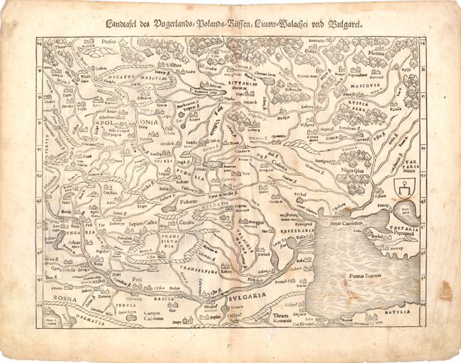
“Landtafel des Ungerlands, Polands, Russen, Littaw, Walachei und Bulgarei”
Map Maker:
Sebastian Munster
Woodblock map of the region containing present-day... (full text available to subscribers)
| Item Detail |
| |
| |
MapMaker: |
Sebastian Munster
|
|
| |
| |
Subject: |
Eastern Europe |
|
| |
Period/Size: |
1578 / 10.0" x 13.5" (25.4 x 34.3 cm)
|
|
| |
Color: |
Black & White
|
|
| |
Condition: |
Some small stains, light toning along centerfold, and a few minute wormholes at right only visible when held to light. There is marginal soiling and some worm tracks in bottom blank margin, one of which just touches neatline. (condition help) |
|
| |
Source: |
Cosmographia |
|
| |
References: |
|
|
| |
|
|
| Sales Information |
| |
| |
Price: |
|
|
| |
| |
Offered by: |
Old World Auctions |
|
| |
Catalog: |
Auction No. 140 - Antique Maps, Charts, Atlases & Globes (9029) |
|
| |
Lot/Item #: |
623 |
|
| |
| |
Date: |
05/2012
|
|
| |
| |
|
Antique Maps - Valuation and Pricing, Descriptions, Resources |
|
Home |
Information |
Search |
Register |
Contact Us |
Site Map
Americana Exchange, Inc. © 1999 - 2024 Americana Exchange, Inc.. All rights reserved.
OldMaps.com, the OldMaps.com logo and
AMPR are service marks or registered service marks of Americana Exchange, Inc..
|