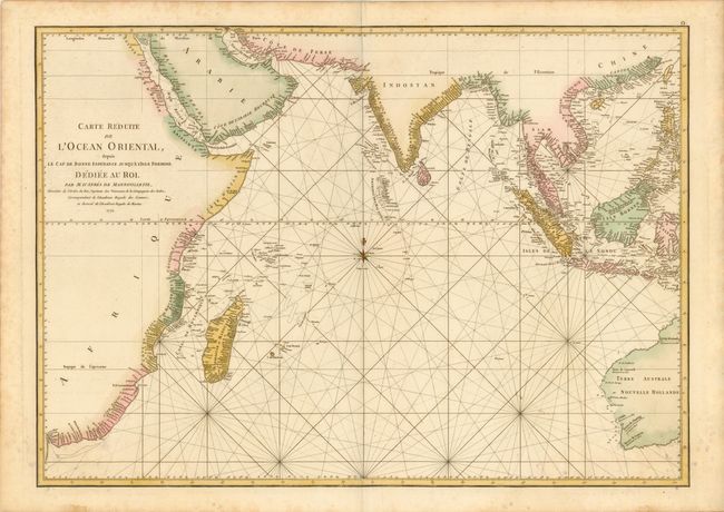
Title:
“Carte Reduite de l'Ocean Oriental, depuis le Cap de Bonne Esperance, jusqu'a l'Isle Formose”
Map Maker:
Jean B.N.D. d' Apres de Mannevillette
A French sailor and hydrographer, D' Aprčs de Mann... (full text available to subscribers)
| Item Detail |
| |
| |
MapMaker: |
Jean B.N.D. d' Apres de Mannevillette
|
|
| |
| |
Subject: |
Indian Ocean |
|
| |
Period/Size: |
1775 / 19.8" x 27.8" (50.3 x 70.7 cm)
|
|
| |
Color: |
Colored
|
|
| |
Condition: |
Printed on heavy watermarked paper with a few light spots and stains primarily in the blank margins. Remnants of hinge tape on verso. (condition help) |
|
| |
Source: |
Le Neptune Oriental |
|
| |
References: |
|
|
| |
|
|
| Sales Information |
| |
| |
Price: |
|
|
| |
| |
Offered by: |
Old World Auctions |
|
| |
Catalog: |
Auction No. 140 - Antique Maps, Charts, Atlases & Globes (9029) |
|
| |
Lot/Item #: |
797 |
|
| |
| |
Date: |
05/2012
|
|
| |
| |
|
Antique Maps - Valuation and Pricing, Descriptions, Resources |
|
Home |
Information |
Search |
Register |
Contact Us |
Site Map
Americana Exchange, Inc. © 1999 - 2024 Americana Exchange, Inc.. All rights reserved.
OldMaps.com, the OldMaps.com logo and
AMPR are service marks or registered service marks of Americana Exchange, Inc..
|