| Item Detail |
| |
| |
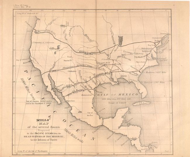
MapMaker: |
U.S. Government
|
|
| |
| |
Subject: |
United States |
|
| |
Period/Size: |
1848 / 8.3" x 9.0" (21.1 x 22.9 cm)
|
|
| |
Color: |
Black & White
|
|
| |
Condition: |
Lightly toned, narrow bottom margin, and 1" centerfold separations at top and bottom that have been closed on verso with archival tape. (condition help) |
|
| |
Source: |
Sen. Doc. #51, 1 Sess. 30th Cong. |
|
| |
References: |
Wheat (Gold) #54; Wheat (TMW) #564. |
|
| |
|
|
| Sales Information |
| |
| |
Price: |
|
|
| |
| |
Offered by: |
Old World Auctions |
|
| |
Catalog: |
Auction No. 140 - Antique Maps, Charts, Atlases & Globes (9029) |
|
| |
Lot/Item #: |
136 |
|
| |
| |
Date: |
05/2012
|
|
| |
| |
|