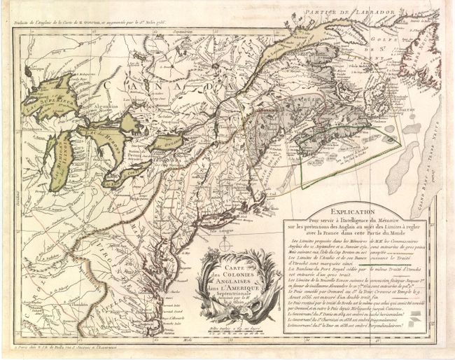
Title:
“Carte des Colonies Anglaises dans l'Amerique Septentrionale Terminee par la Re. Ohio”
Map Maker:
Nicolas J.D. de Poilly
This uncommon map is one of a series of important ... (full text available to subscribers)
| Item Detail |
| |
| |
MapMaker: |
Nicolas J.D. de Poilly
|
|
| |
| |
Subject: |
Eastern Canada & United States |
|
| |
Period/Size: |
1756 / 14.5" x 18.3" (36.9 x 46.5 cm)
|
|
| |
Color: |
Colored
|
|
| |
Condition: |
Original color with a few minute wormholes. Margins have been extended at bottom and sides to better accommodate framing. Issued folding. (condition help) |
|
| |
Source: |
|
|
| |
References: |
McCorkle #756.13; Sellers & Van Ee #71. |
|
| |
|
|
| Sales Information |
| |
| |
Price: |
|
|
| |
| |
Offered by: |
Old World Auctions |
|
| |
Catalog: |
Auction No. 140 - Antique Maps, Charts, Atlases & Globes (9029) |
|
| |
Lot/Item #: |
123 |
|
| |
| |
Date: |
05/2012
|
|
| |
| |
|
Antique Maps - Valuation and Pricing, Descriptions, Resources |
|
Home |
Information |
Search |
Register |
Contact Us |
Site Map
Americana Exchange, Inc. © 1999 - 2024 Americana Exchange, Inc.. All rights reserved.
OldMaps.com, the OldMaps.com logo and
AMPR are service marks or registered service marks of Americana Exchange, Inc..
|