| Item Detail |
| |
| |
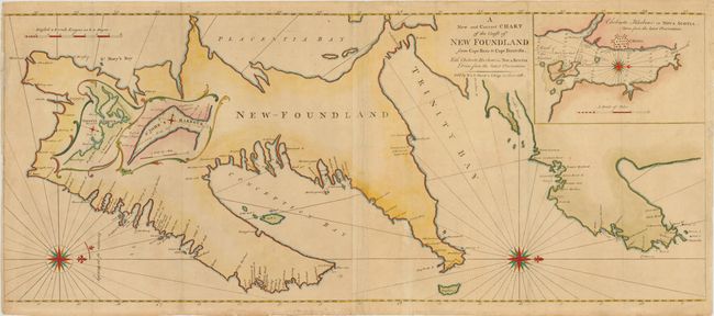
MapMaker: |
Mount & Page
|
|
| |
| |
Subject: |
Newfoundland, Canada |
|
| |
Period/Size: |
1753 / 16.8" x 40.0" (42.7 x 101.6 cm)
|
|
| |
Color: |
Colored
|
|
| |
Condition: |
Good impression with a close margin at left with some paper laid in and a little facsimile on neatline. There are a couple of short tears across centerfold. (condition help) |
|
| |
Source: |
The English Pilot: The Fourth Book |
|
| |
References: |
Kershaw #523; Shirley (BL Atlases) M.M&P-5d #7. |
|
| |
|
|
| Sales Information |
| |
| |
Price: |
|
|
| |
| |
Offered by: |
Old World Auctions |
|
| |
Catalog: |
Auction No. 140 - Antique Maps, Charts, Atlases & Globes (9029) |
|
| |
Lot/Item #: |
107 |
|
| |
| |
Date: |
05/2012
|
|
| |
| |
|