Title:
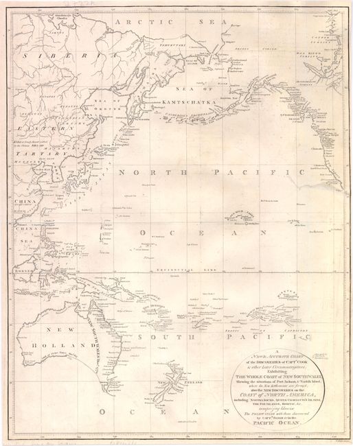
“A New & Accurate Chart of the Discoveries of Captn. Cook & other Later Circumnavigators: Exhibiting the Whole Coast of New South Wales, Shewing the Situations of Port Jackson, & Norfolk Island, where the New Settlements are Formedģ”
Map Maker:
William Guthrie
This map illustrates the discoveries of eighteenth... (full text available to subscribers)
| Item Detail |
| |
| |
MapMaker: |
William Guthrie
|
|
| |
| |
Subject: |
Pacific Ocean |
|
| |
Period/Size: |
1795 / 16.8" x 13.3" (42.7 x 33.8 cm)
|
|
| |
Color: |
Black & White
|
|
| |
Condition: |
Issued folding, now pressed with light offsetting and a minor spot of soiling. There is an archivally repaired tear that enters 2.5" into map at right with a narrow right margin. Backed in Japanese tissue. (condition help) |
|
| |
Source: |
|
|
| |
References: |
|
|
| |
|
|
| Sales Information |
| |
| |
Price: |
|
|
| |
| |
Offered by: |
Old World Auctions |
|
| |
Catalog: |
Auction No. 140 - Antique Maps, Charts, Atlases & Globes (9029) |
|
| |
Lot/Item #: |
828 |
|
| |
| |
Date: |
05/2012
|
|
| |
| |
|
Antique Maps - Valuation and Pricing, Descriptions, Resources |
|
Home |
Information |
Search |
Register |
Contact Us |
Site Map
Americana Exchange, Inc. © 1999 - 2024 Americana Exchange, Inc.. All rights reserved.
OldMaps.com, the OldMaps.com logo and
AMPR are service marks or registered service marks of Americana Exchange, Inc..
|