Title:
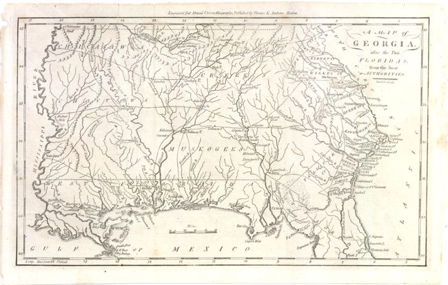
“A Map of Georgia, also the Two Floridas, from the Best Authorities”
Map Maker:
Thomas & Andrews
This is an early American map depicting Georgia Te... (full text available to subscribers)
| Item Detail |
| |
| |
MapMaker: |
Thomas & Andrews
|
|
| |
| |
Subject: |
Southern United States - Georgia |
|
| |
Period/Size: |
1796 / 7.3" x 12.0" (18.6 x 30.5 cm)
|
|
| |
Color: |
Black & White
|
|
| |
Condition: |
Issued folding, now pressed with a few small spots and an archivally repaired tear that enters 1/2" into map at top left. (condition help) |
|
| |
Source: |
Morse's Universal Geography |
|
| |
References: |
Wheat & Brun #614. |
|
| |
|
|
| Sales Information |
| |
| |
Price: |
|
|
| |
| |
Offered by: |
Old World Auctions |
|
| |
Catalog: |
Auction No. 140 - Antique Maps, Charts, Atlases & Globes (9029) |
|
| |
Lot/Item #: |
179 |
|
| |
| |
Date: |
05/2012
|
|
| |
| |
|
Antique Maps - Valuation and Pricing, Descriptions, Resources |
|
Home |
Information |
Search |
Register |
Contact Us |
Site Map
Americana Exchange, Inc. © 1999 - 2024 Americana Exchange, Inc.. All rights reserved.
OldMaps.com, the OldMaps.com logo and
AMPR are service marks or registered service marks of Americana Exchange, Inc..
|