| Item Detail |
| |
| |
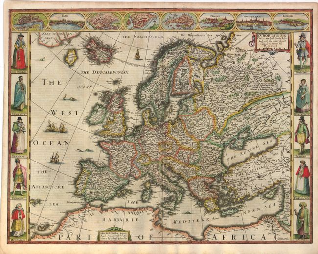
MapMaker: |
John Speed
|
|
| |
| |
Subject: |
Europe |
|
| |
Period/Size: |
1626 / 15.5" x 20.0" (39.4 x 50.8 cm)
|
|
| |
Color: |
Colored
|
|
| |
Condition: |
Attractive color on watermarked paper with light show-through of text on verso, minor soiling, and professional paper repairs along centerfold. There is a small repaired hole in the Gulf of Venice with minor loss of image. Expertly remargined on all fou (condition help) |
|
| |
Source: |
A Prospect of the Most Famous Parts of the World |
|
| |
References: |
Shirley (BL Atlases) T.SPE-2a #4. |
|
| |
|
|
| Sales Information |
| |
| |
Price: |
|
|
| |
| |
Offered by: |
Old World Auctions |
|
| |
Catalog: |
Auction No. 140 - Antique Maps, Charts, Atlases & Globes (9029) |
|
| |
Lot/Item #: |
430 |
|
| |
| |
Date: |
05/2012
|
|
| |
| |
|