| Item Detail |
| |
| |
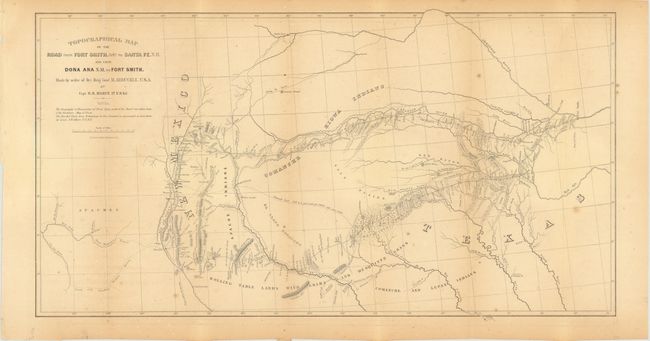
MapMaker: |
Randolph Barnes Marcy
|
|
| |
| |
Subject: |
Southwestern United States |
|
| |
Period/Size: |
1850 / 14.5" x 27.5" (36.9 x 69.9 cm)
|
|
| |
Color: |
Black & White
|
|
| |
Condition: |
Light scattered foxing and toning along the folds. The pages are mostly clean with some scattered light foxing and a few stains on the title page. Map and report are housed in an attractive, contemporary brown clamshell folder. (condition help) |
|
| |
Source: |
31 Cong., 1st Sess, House Ex. Doc No. 45 |
|
| |
References: |
Howes S500, [map] Wheat TMW #681. |
|
| |
|
|
| Sales Information |
| |
| |
Price: |
|
|
| |
| |
Offered by: |
Old World Auctions |
|
| |
Catalog: |
Auction No. 140 - Antique Maps, Charts, Atlases & Globes (9029) |
|
| |
Lot/Item #: |
201 |
|
| |
| |
Date: |
05/2012
|
|
| |
| |
|