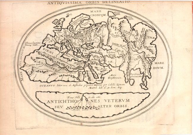
Title:
“Antiquissima Orbis Delineatio”
Map Maker:
Philippe Briet
This interesting map shows two distinct regions of... (full text available to subscribers)
| Item Detail |
| |
| |
MapMaker: |
Philippe Briet
|
|
| |
| |
Subject: |
Ancient World |
|
| |
Period/Size: |
1649 / 6.3" x 8.0" (16.0 x 20.4 cm)
|
|
| |
Color: |
Black & White
|
|
| |
Condition: |
(B+ ) Light toning primarily along the sides of the sheet away from the image and a few minor spots. Upper margin trimmed with a tiny portion of the title missing. (condition help) |
|
| |
Source: |
|
|
| |
References: |
|
|
| |
|
|
| Sales Information |
| |
| |
Price: |
|
|
| |
| |
Offered by: |
Old World Auctions |
|
| |
Catalog: |
Auction No. 141 - Antique Maps, Charts, Atlases & Globes (9037) |
|
| |
Lot/Item #: |
51 |
|
| |
| |
Date: |
09/2012
|
|
| |
| |
|
Antique Maps - Valuation and Pricing, Descriptions, Resources |
|
Home |
Information |
Search |
Register |
Contact Us |
Site Map
Americana Exchange, Inc. © 1999 - 2024 Americana Exchange, Inc.. All rights reserved.
OldMaps.com, the OldMaps.com logo and
AMPR are service marks or registered service marks of Americana Exchange, Inc..
|