| Item Detail |
| |
| |
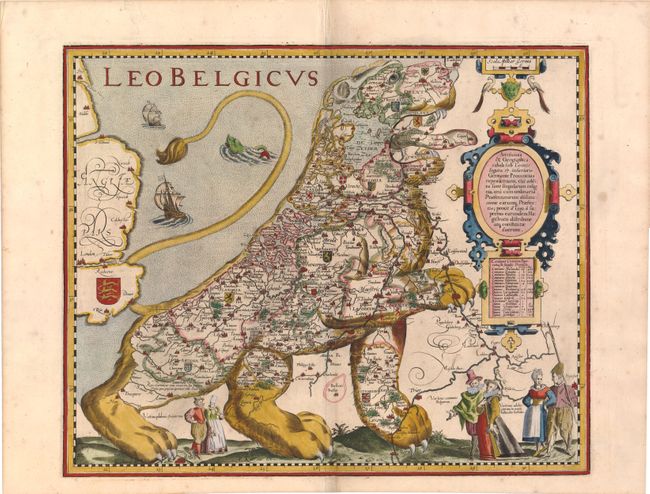
MapMaker: |
Pieter Van Den Keere
|
|
| |
| |
Subject: |
Cartographic Miscellany, Belgium and Netherlands |
|
| |
Period/Size: |
1617 / 14.5" x 17.8" (36.9 x 45.3 cm)
|
|
| |
Color: |
Colored
|
|
| |
Condition: |
(B+ ) Attractive color with a faint printer's crease adjacent to centerfold, some light spots, and a few minute worm holes only visible when held to light. There is a tiny hole adjacent to centerfold at bottom that has been professionally repaired. (condition help) |
|
| |
Source: |
Petri Kaerii Germania Inferior… |
|
| |
References: |
Tooley (MCC-7) #11; Map Collector Magazine, Issue 14, pp. 48-50. |
|
| |
|
|
| Sales Information |
| |
| |
Price: |
|
|
| |
| |
Offered by: |
Old World Auctions |
|
| |
Catalog: |
Auction No. 141 - Antique Maps, Charts, Atlases & Globes (9037) |
|
| |
Lot/Item #: |
67 |
|
| |
| |
Date: |
09/2012
|
|
| |
| |
|