Title:
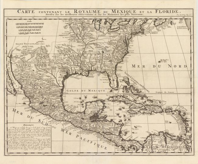
“Carte Contenant le Royaume du Mexique et la Floride, Dressez sur les Meilleures Observations & sur les Memoires les plus Nouveaux”
Map Maker:
Henry Abraham Chatelain
This is a derivative of Delisle's landmark map of ... (full text available to subscribers)
| Item Detail |
| |
| |
MapMaker: |
Henry Abraham Chatelain
|
|
| |
| |
Subject: |
Colonial North America and Caribbean |
|
| |
Period/Size: |
1719 / 16.3" x 20.8" (41.4 x 52.9 cm)
|
|
| |
Color: |
Black & White
|
|
| |
Condition: |
(A ) A fine impression on bright paper with just a hint of toning along centerfold. The tops of the side margins have been extended slightly to better accommodate framing. (condition help) |
|
| |
Source: |
Atlas Historiqueģ |
|
| |
References: |
Martin & Martin, p. 93. |
|
| |
|
|
| Sales Information |
| |
| |
Price: |
|
|
| |
| |
Offered by: |
Old World Auctions |
|
| |
Catalog: |
Auction No. 141 - Antique Maps, Charts, Atlases & Globes (9037) |
|
| |
Lot/Item #: |
107 |
|
| |
| |
Date: |
09/2012
|
|
| |
| |
|
Antique Maps - Valuation and Pricing, Descriptions, Resources |
|
Home |
Information |
Search |
Register |
Contact Us |
Site Map
Americana Exchange, Inc. © 1999 - 2024 Americana Exchange, Inc.. All rights reserved.
OldMaps.com, the OldMaps.com logo and
AMPR are service marks or registered service marks of Americana Exchange, Inc..
|