Title:
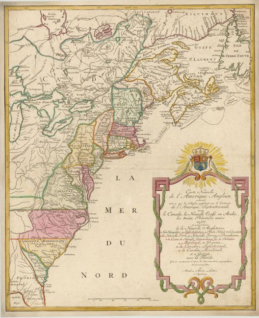
“Carte Nouvelle de l'Amerique Angloise contenant tout ce que les Anglois Possedent sur le Continent de l'Amerique Septentrionale Savoir le Canada, la Nouvelle Ecosse ou Acadie, les Treize Provinces Unies…”
Map Maker:
Matthaus Albrecht Lotter
This handsome map was issued shortly before the ou... (full text available to subscribers)
| Item Detail |
| |
| |
MapMaker: |
Matthaus Albrecht Lotter
|
|
| |
| |
Subject: |
Colonial United States & Canada |
|
| |
Period/Size: |
1776 / 23.8" x 19.5" (60.5 x 49.6 cm)
|
|
| |
Color: |
Colored
|
|
| |
Condition: |
(B+ ) Minor soiling with a professionally repaired separation below the centerfold. Expertly remargined on all four sides. (condition help) |
|
| |
Source: |
|
|
| |
References: |
McCorkle #776.19; Sellers & Van Ee #141. |
|
| |
|
|
| Sales Information |
| |
| |
Price: |
|
|
| |
| |
Offered by: |
Old World Auctions |
|
| |
Catalog: |
Auction No. 141 - Antique Maps, Charts, Atlases & Globes (9037) |
|
| |
Lot/Item #: |
131 |
|
| |
| |
Date: |
09/2012
|
|
| |
| |
|
Antique Maps - Valuation and Pricing, Descriptions, Resources |
|
Home |
Information |
Search |
Register |
Contact Us |
Site Map
Americana Exchange, Inc. © 1999 - 2024 Americana Exchange, Inc.. All rights reserved.
OldMaps.com, the OldMaps.com logo and
AMPR are service marks or registered service marks of Americana Exchange, Inc..
|