| Item Detail |
| |
| |
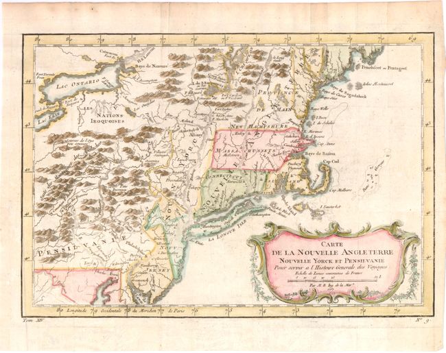
MapMaker: |
Jacques Nicolas Bellin
|
|
| |
| |
Subject: |
Colonial New England and Mid-Atlantic |
|
| |
Period/Size: |
1757 / 8.1" x 11.8" (20.6 x 30.0 cm)
|
|
| |
Color: |
Colored
|
|
| |
Condition: |
(B+ ) Issued folding, now pressed on watermarked paper with a few minute worm holes only visible when held to light. The impression is weak around Manhattan. A binding trim at bottom left has been repaired with old paper. (condition help) |
|
| |
Source: |
Prevost's Histoire Generale des Voyages |
|
| |
References: |
McCorkle #757.1; Sellers & Van Ee #721. |
|
| |
|
|
| Sales Information |
| |
| |
Price: |
|
|
| |
| |
Offered by: |
Old World Auctions |
|
| |
Catalog: |
Auction No. 141 - Antique Maps, Charts, Atlases & Globes (9037) |
|
| |
Lot/Item #: |
162 |
|
| |
| |
Date: |
09/2012
|
|
| |
| |
|