| Item Detail |
| |
| |
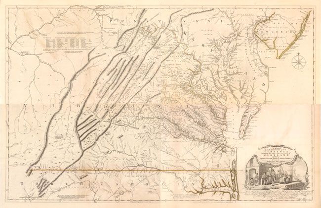
MapMaker: |
Thomas Jefferys
|
|
| |
| |
Subject: |
Colonial Virginia, Maryland |
|
| |
Period/Size: |
1775 / 31.0" x 48.5" (78.8 x 123.2 cm)
|
|
| |
Color: |
Colored
|
|
| |
Condition: |
(B+ ) Strong impression on watermarked paper in original outline color. There are some areas of light offsetting, most notably on the upper sheet at left as well as some areas of light toning and a few minor spots. The map has been professionally remov (condition help) |
|
| |
Source: |
Thomas Jefferys' American Atlas |
|
| |
References: |
Stephenson & Mckee, pp. 52-55, 83; Pritchard & Taliaferro pp. 154-159; Cummings (SE) #281, #449. |
|
| |
|
|
| Sales Information |
| |
| |
Price: |
|
|
| |
| |
Offered by: |
Old World Auctions |
|
| |
Catalog: |
Auction No. 141 - Antique Maps, Charts, Atlases & Globes (9037) |
|
| |
Lot/Item #: |
167 |
|
| |
| |
Date: |
09/2012
|
|
| |
| |
|