Title:
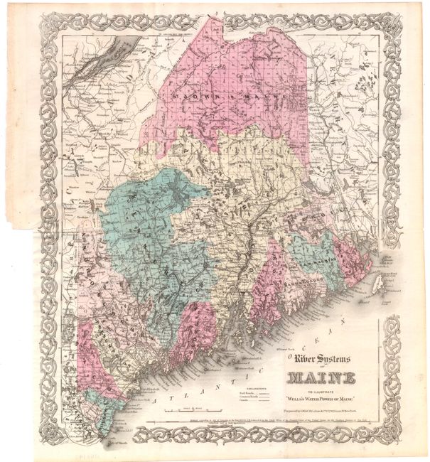
“River Systems of Maine to Illustrate Wells's Water Power of Maine”
Map Maker:
G.W. & C.B Colton [& Co.]
Map individually colors each of the counties and d... (full text available to subscribers)
| Item Detail |
| |
| |
MapMaker: |
G.W. & C.B Colton [& Co.]
|
|
| |
| |
Subject: |
Maine |
|
| |
Period/Size: |
1869 / 15.1" x 12.6" (38.4 x 32.0 cm)
|
|
| |
Color: |
Colored
|
|
| |
Condition: |
(A ) Issued folding with a binding trim at left, not affecting map. (condition help) |
|
| |
Source: |
|
|
| |
References: |
|
|
| |
|
|
| Sales Information |
| |
| |
Price: |
|
|
| |
| |
Offered by: |
Old World Auctions |
|
| |
Catalog: |
Auction No. 141 - Antique Maps, Charts, Atlases & Globes (9037) |
|
| |
Lot/Item #: |
228 |
|
| |
| |
Date: |
09/2012
|
|
| |
| |
|
Antique Maps - Valuation and Pricing, Descriptions, Resources |
|
Home |
Information |
Search |
Register |
Contact Us |
Site Map
Americana Exchange, Inc. © 1999 - 2024 Americana Exchange, Inc.. All rights reserved.
OldMaps.com, the OldMaps.com logo and
AMPR are service marks or registered service marks of Americana Exchange, Inc..
|