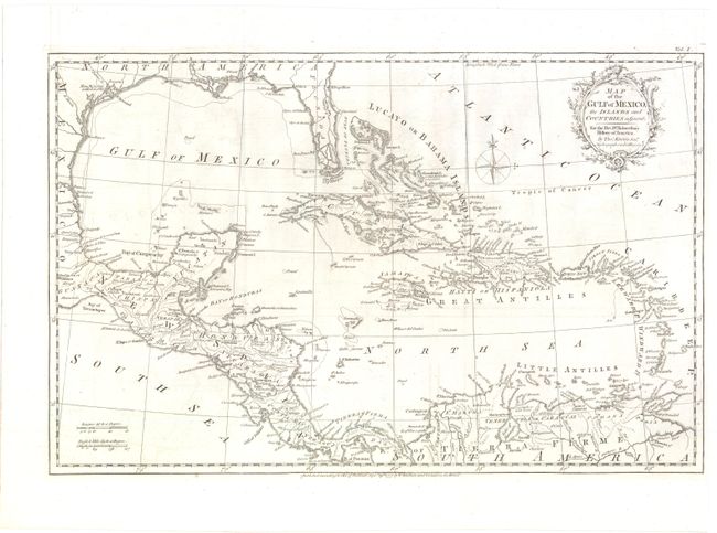
Title:
“Map of the Gulf of Mexico, the Islands and Countries Adjacent”
Map Maker:
Thomas Kitchin
Lovely copper engraved map covering the region fro... (full text available to subscribers)
| Item Detail |
| |
| |
MapMaker: |
Thomas Kitchin
|
|
| |
| |
Subject: |
Gulf of Mexico and Caribbean |
|
| |
Period/Size: |
1777 / 12.5" x 19.3" (31.8 x 49.1 cm)
|
|
| |
Color: |
Black & White
|
|
| |
Condition: |
(B+ ) Issued folding with a couple of minute separations at fold intersections and faint offsetting. (condition help) |
|
| |
Source: |
Robertson's History of America |
|
| |
References: |
Howes #R358. |
|
| |
|
|
| Sales Information |
| |
| |
Price: |
|
|
| |
| |
Offered by: |
Old World Auctions |
|
| |
Catalog: |
Auction No. 141 - Antique Maps, Charts, Atlases & Globes (9037) |
|
| |
Lot/Item #: |
303 |
|
| |
| |
Date: |
09/2012
|
|
| |
| |
|
Antique Maps - Valuation and Pricing, Descriptions, Resources |
|
Home |
Information |
Search |
Register |
Contact Us |
Site Map
Americana Exchange, Inc. © 1999 - 2024 Americana Exchange, Inc.. All rights reserved.
OldMaps.com, the OldMaps.com logo and
AMPR are service marks or registered service marks of Americana Exchange, Inc..
|