| Item Detail |
| |
| |
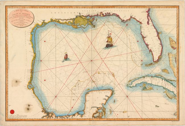
MapMaker: |
Depot de la Marine
|
|
| |
| |
Subject: |
Gulf of Mexico and Caribbean |
|
| |
Period/Size: |
1800 / 23.8" x 35.8" (60.5 x 91.0 cm)
|
|
| |
Color: |
Colored
|
|
| |
Condition: |
(B ) Watermarked paper with some faint damp stains, light soiling, and short centerfold separations in the top and bottom blank margins, just entering the map border at bottom. There is a tear that enters 2" into map at bottom right that was closed on (condition help) |
|
| |
Source: |
|
|
| |
References: |
cf Martin & Martin, p. 105. |
|
| |
|
|
| Sales Information |
| |
| |
Price: |
|
|
| |
| |
Offered by: |
Old World Auctions |
|
| |
Catalog: |
Auction No. 141 - Antique Maps, Charts, Atlases & Globes (9037) |
|
| |
Lot/Item #: |
305 |
|
| |
| |
Date: |
09/2012
|
|
| |
| |
|