Title:
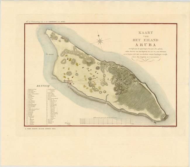
“Kaart van Het Eiland Aruba Gevolgd Naar de Opmeting in den Jare 1820 Gedaan, Onder Directie van den Kapitein ter Zee W.A. van Spengler en in den Jare 1825 met Verscheidene Nieuwe Bepalingen Verrijkt”
Map Maker:
Daniel Veelwaard
This rare map of Aruba, one of the Dutch Antilles ... (full text available to subscribers)
| Item Detail |
| |
| |
MapMaker: |
Daniel Veelwaard
|
|
| |
| |
Subject: |
Aruba |
|
| |
Period/Size: |
1827 / 11.7" x 17.4" (29.8 x 44.2 cm)
|
|
| |
Color: |
Colored
|
|
| |
Condition: |
(A+ ) Issued folding on watermarked paper with wide margins and very minor soiling in blank margins. (condition help) |
|
| |
Source: |
|
|
| |
References: |
|
|
| |
|
|
| Sales Information |
| |
| |
Price: |
|
|
| |
| |
Offered by: |
Old World Auctions |
|
| |
Catalog: |
Auction No. 141 - Antique Maps, Charts, Atlases & Globes (9037) |
|
| |
Lot/Item #: |
328 |
|
| |
| |
Date: |
09/2012
|
|
| |
| |
|
Antique Maps - Valuation and Pricing, Descriptions, Resources |
|
Home |
Information |
Search |
Register |
Contact Us |
Site Map
Americana Exchange, Inc. © 1999 - 2024 Americana Exchange, Inc.. All rights reserved.
OldMaps.com, the OldMaps.com logo and
AMPR are service marks or registered service marks of Americana Exchange, Inc..
|